


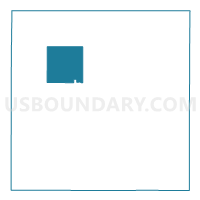
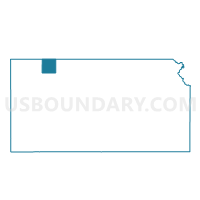
Liberty Township Voting District, Decatur County, Kansas
About
Outline

Summary
| Unique Area Identifier | 584456 |
| Name | Liberty Township Voting District |
| County | Decatur County |
| State | Kansas |
| Area (square miles) | 35.14 |
| Land Area (square miles) | 35.13 |
| Water Area (square miles) | 0.01 |
| % of Land Area | 99.97 |
| % of Water Area | 0.03 |
| Latitude of the Internal Point | 39.87464640 |
| Longtitude of the Internal Point | -100.56898210 |
Maps

Graphs
Select a template below for downloading or customizing gragh for Liberty Township Voting District, Decatur County, Kansas


Neighbors
Neighoring Voting District (by Name) Neighboring Voting District on the Map
- Beaver Township Voting District, Decatur County, KS
- Center Township Voting District, Decatur County, KS
- Finley Township Voting District, Decatur County, KS
- Logan Township Voting District, Decatur County, KS
- Oberlin City Precinct 1, Decatur County, KS
- Oberlin City Precinct 2, Decatur County, KS
- Oberlin Township Voting District, Decatur County, KS
- Olive Township Voting District, Decatur County, KS
- Sappa Township Voting District, Decatur County, KS
Top 10 Neighboring County Subdivision (by Population) Neighboring County Subdivision on the Map
- Oberlin city, Decatur County, KS (1,788)
- Beaver township, Decatur County, KS (82)
- Oberlin township, Decatur County, KS (81)
- Center township, Decatur County, KS (58)
- Liberty township, Decatur County, KS (51)
- Finley township, Decatur County, KS (49)
- Sappa township, Decatur County, KS (36)
- Olive township, Decatur County, KS (33)
- Logan township, Decatur County, KS (33)